
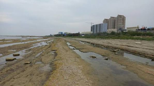
The actual land area of the Republic of Dagestan has expanded by 2,000 to 3,000 square kilometers as a result of the falling Caspian Sea level.
Sea-news.az reports that geologist and candidate of geographical sciences Idris Idrisov disclosed this information to RIA Novosti.
He explained the process by the receding waters and the merging of several islands with the mainland. According to the specialist, the decline in the Caspian Sea’s level causes new land areas to emerge. Certain islands that were previously separated from the coast by water have already joined the mainland.
“Islands such as Yaichny, Chechen, Pichuzhonok, Bazar, and Prygunki have already connected to the land. It is possible to reach them by car,” Idrisov stated.
The geologist estimated Dagestan’s current land area to be approximately 52,000 to 53,000 square kilometers, up from the previous 50.3 thousand square kilometers. It should be noted that this refers to an actual shift in the coastline rather than an official revision of the region’s administrative borders.
Establishing the precise territory of Dagestan requires preparing updated topographic maps of the Caspian Sea’s coastal zone. These maps will allow for the official mapping of land areas exposed by the receding water.
Changes also continue in Kizlyar Bay, where the roughly 63-hectare Nordovy Island is located. Idrisov projected that if the sea level drops by less than another meter, the island could fully connect to the mainland. The island hosts large nesting colonies of seabirds.
Nevertheless, the shoaling of the Caspian Sea remains a critical environmental issue. The retreat of the water alters natural conditions along coastal areas and could exert negative impacts on local ecosystems.